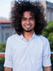
Researcher biography
Qualifications:
- Bachelor of Science in Cartography, Remote Sensing, and Geography Information System, Faculty of Geography, Universitas Gadjah Mada, Indonesia
- Master of Science in Planning and Management of Coastal and Watershed, Faculty of Geography, Universitas Gadjah Mada, Indonesia
Project title:
ESTIMATING SEAGRASS CARBON STOCK USING REMOTE SENSING TECHNOLOGY FOR INDONESIA
Project description:
The aim is to estimate carbon stock at a whole country scale, with local level detail, for Indonesia, but integrating field and satellite data sets. To achieve it, four objectives will be conducted, which are:
1) Develop a process to integrate multi-source field data of seagrass biophysical properties across Indonesia, for mapping and monitoring seagrass above-ground-biomass and carbon stocks across Indonesia,
2) Development and assessment of a process(es) using multi-source field data and satellite data to map Indonesian seagrass properties that are directly related to above-ground biomass and carbon stocks,
3) Develop and test at selected representative sites across Indonesia, suitable empirical model(s) using multi-source field data and satellite data to map Indonesian seagrass above-ground biomass (Objective 2), and then estimate above ground seagrass carbon stocks.
4) Estimate seagrass above-ground biomass and carbon stocks across Indonesia using the processes developed in objectives 1-3, and critically assess the output, methods and assumptions.
Funding:
The Indonesia Endowment Funds for Education (LPDP)
